
History: Oil Creek State Park is one of five state parks established through the efforts of the Western Pennsylvania Conservancy. The
7,300 acre tract of land preserves 12 miles of the winding Oil Creek gorge,
 which stretches south into Venango County from the Crawford County line, created approximately 10,000 years ago by the draining of an ice-dammed glacial lake.
The discovery of oil in the valley on August 27, 1859 marked the birth of the world's oil industry Throughout the park, expect to see cultural and natural resources.
As the second growth forest health improves, it gives a physical reminder of nature's ability to reclaim the landscape. Habitat is provided for wildlife including a large population of white-tailed deer, turkey, bear, ruffed grouse, squirrels and various winter birds.
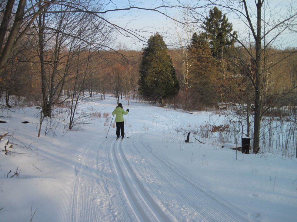
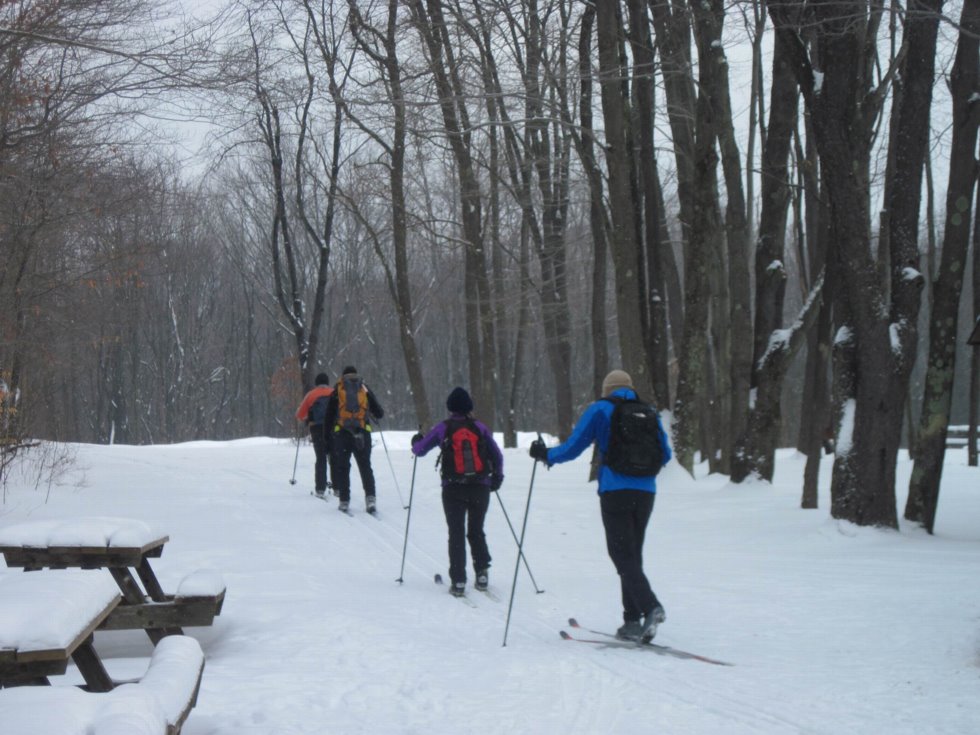
Being located in northwestern Pennsylvania generally ensures lake effect snow cover for cross-country skiing for much of the winter. During the winter of 1984-85, Oil Creek State Park developed a cross-country ski area with a network of 11.1 miles of marked trails, on the plateau of the east rim of the gorge.
A parking lot, warming hut and restrooms enhance the opportunity for skiers to enjoy and explore. Fire wood is usually available at the warming hut. Fire wood is cut, split and stacked by the Over the Hill Gang
In the fall and spring volunteers of the Friends of Oil Creek State Park gather to clean and improve the ski trails for year-round use. Ski Trail Workdays involve volunteers clearing fallen trees, cutting small trees and branches from the trail edges, painting blaze markings, and improving drainage in wet areas. Eagle Scout projects have also improved the trails and signage.
The Park's cross-country ski area features three main trails, Red, Blue, Green (based on blaze color) with six White connecting trails. Most of the trails utilize old oil lease and lumber roads and are generally about 10 feet wide.
At the parking lot you will notice a warming hut at the trail head and restrooms on the west side. These are available from 8 AM till sunset.
Inside the hut you will find a wood burning stove and several picnic tables. Fire wood is usually available at the warming hut. Fire wood is cut, split and stacked by the Over the Hill Gang
The Green and Blue Loops are suitable for, beginning skiers. The Blue Loop (2.6 mi.) is relatively flat with one steep section and is longer than the Green Loop (0.6 mi.). The Red Loop (5.8 mi.) is very challenging due to its distance, several steep hills and some sharp turns, it also leads to a very impressive scenic view.
Ski Trail Map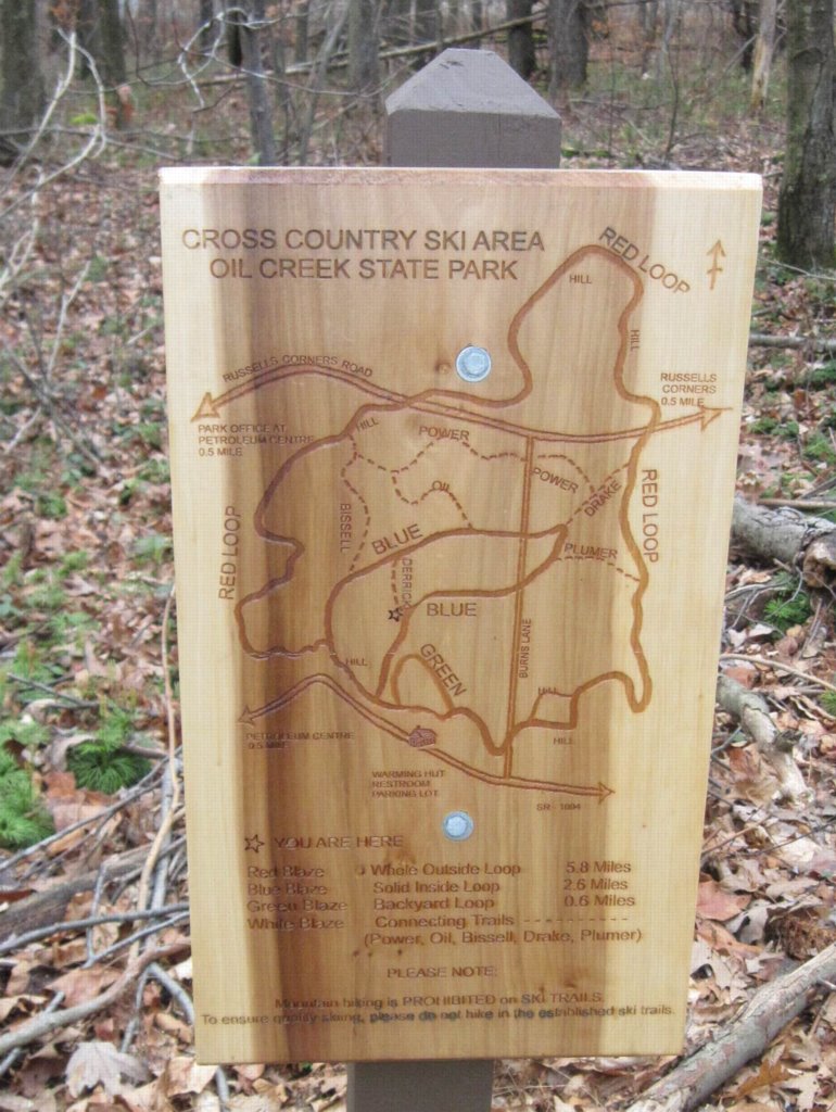
Signs showing the trail map are located throughout the ski area.

lf you follow the red color trail 1.5 miles westward or clockwise from the warming hut to an overlook, across the valley you will see the Benninghoff Tableau Site, the railroad bridge at Pioneer and six derricks with oil related buildings, machinery, equipment and materials. Though this is not a working site, it can give you a feel for what the area was like in the 1860's and 70's.
Beyond the scenic vista the trail merges with the Gerard Hiking Trail(Yellow blazing) several times for short distances. You will want to stay with the red blazing to stay on the Red Loop.
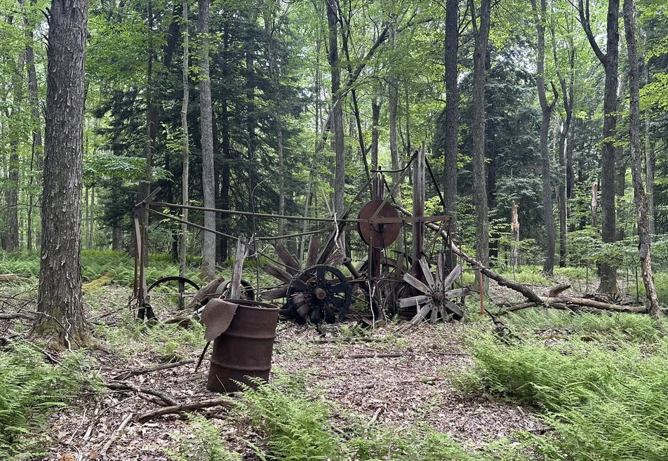
Along the trail you will see several ruminants of the old oil industry. A Wolf Drilling Rig is visible from the Red Trail near its intersection with Russell Corners Road.
By utilizing the Red, Blue, Green loops and six White connector trails the skiing possibilities are almost endless making some very unique, exciting and challenging combinations.
There are elements of risk in skiing that common sense and personal awareness can help reduce.
In addition to the above rules please follow the common courtesies below.
If your planning to be at the park for more than one day or don't plan to drive home after a day of skiing, hiking, biking or hunting, consider some of the following for your stay in the area. Click on the name for additional information.
| Name | Address | Phone |
| Quality Inn & Conference Center | 1411 Liberty St, Franklin, PA | 814-437-3031 |
| Knights Inn | Rt. 8 Franklin, PA | 814-432-2101 |
| Quality Inn | 511 W. Central Ave., Titusville, PA | 814-827-0041 |
| Caboose Motel | Perry Street, Titusville, PA | 800-827-0690 |
| Holiday Inn Express | 225 Sinch Dr.,Route 257, Cranberry, PA | 814-677-2640 |
| Cross Creek Resort | 3815 State Route 8, Titusville PA | 814-827-9611 |
| Bromley's Hillhurst B & B | 701 N. Perry St., Titusville PA 16354 | 814-827-1101 |
| McMullen House B & B | 430 E. Main St., Titusville PA 16354 | 814-775-0005 |
Oil Creek State Park, Tenting and Adirondack type shelters (walk in only) 814-676-5915 - Reservation Required
Oil Creek Camp Ground, 340 Shreve Rd., Titusville, PA 814-827-1023